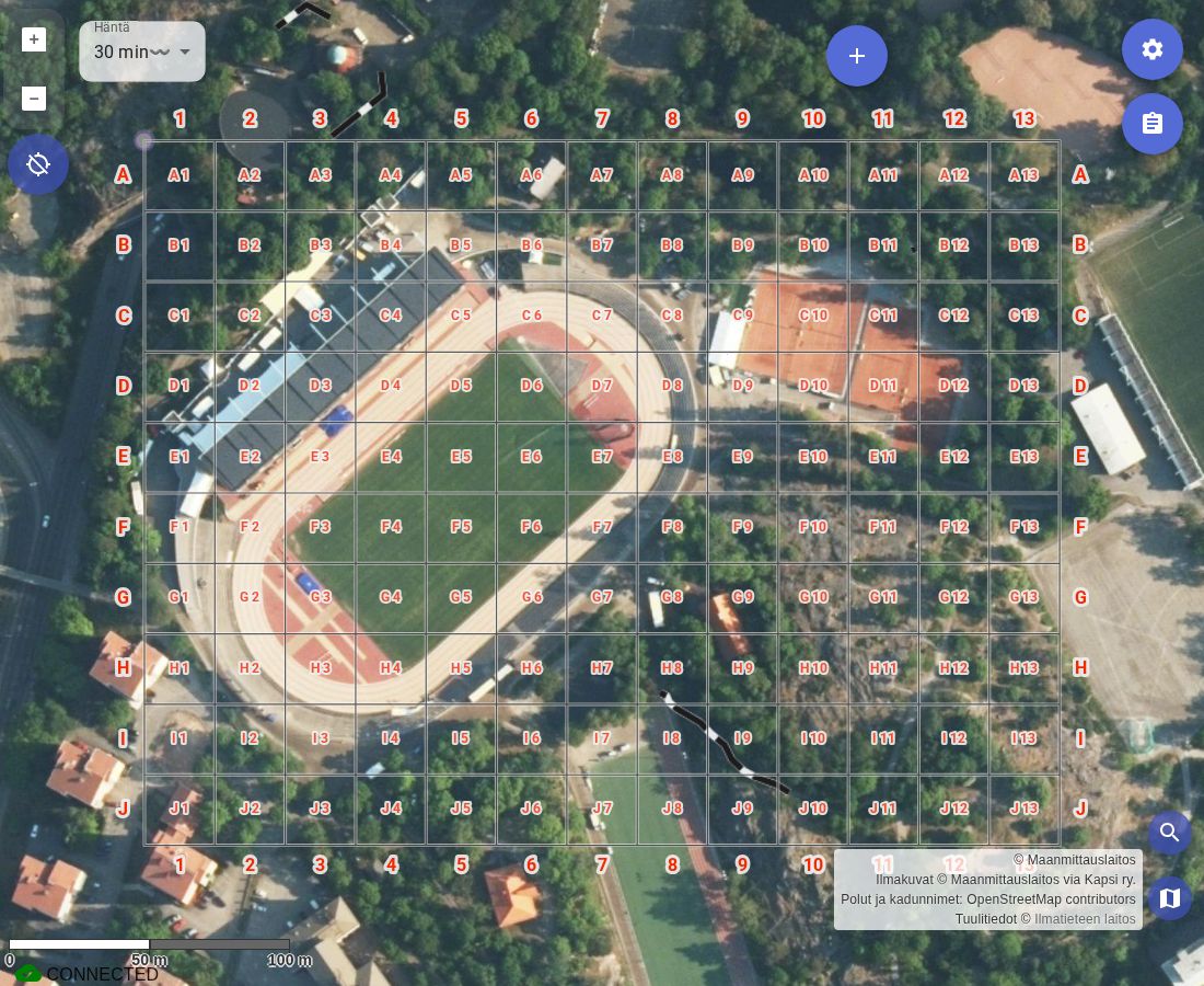
Coordinate grid for event coordination
Event first aid cover and security operations have long used a coordinate grid as a standard map for the event area. Karttahimmeli supports this established practice directly.
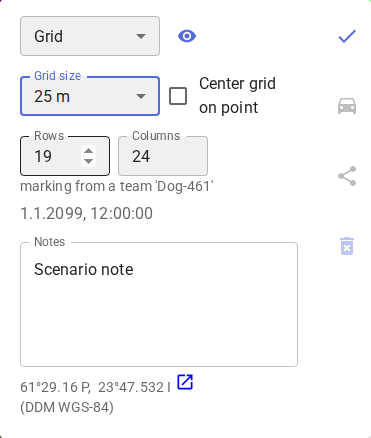
The Grid marking type draws a coordinate grid on the map. Selecting it opens a set of controls:
- Grid size — cell edge length, 25 m or 50 m
- Rows and Columns — grid dimensions, 5–30 columns and 5–26 rows (rows are lettered, so 26 is the ceiling)
- Center grid on point — anchors the grid on the tapped point instead of using it as the top-left corner (see below)
- Columns are numbered left to right: 1, 2, 3 …
- Rows are lettered top to bottom: A, B, C …
A location can be communicated as a grid coordinate, e.g. B7 — all members of the operation can immediately find it on their map without further explanation, and the location is also easy to find on a printed map.
How to use
Press plus button → select Other → select Grid → tap the point on the map where the grid should be anchored, then adjust size, rows, columns, and centering in the popup as needed. The grid becomes visible when the map is zoomed in to approximately level 14 or deeper.
By default, the tapped point becomes the grid's top-left corner. Ticking Center grid on point instead centers the grid on that point — the point always lands exactly on a line intersection, never mid-cell, so it stays a usable reference coordinate either way.
The grid can also be used in search and rescue operations whenever the area needs to be divided into coordinated sectors.